White Phosphorus in Gaza
Communicating evidence through visual design
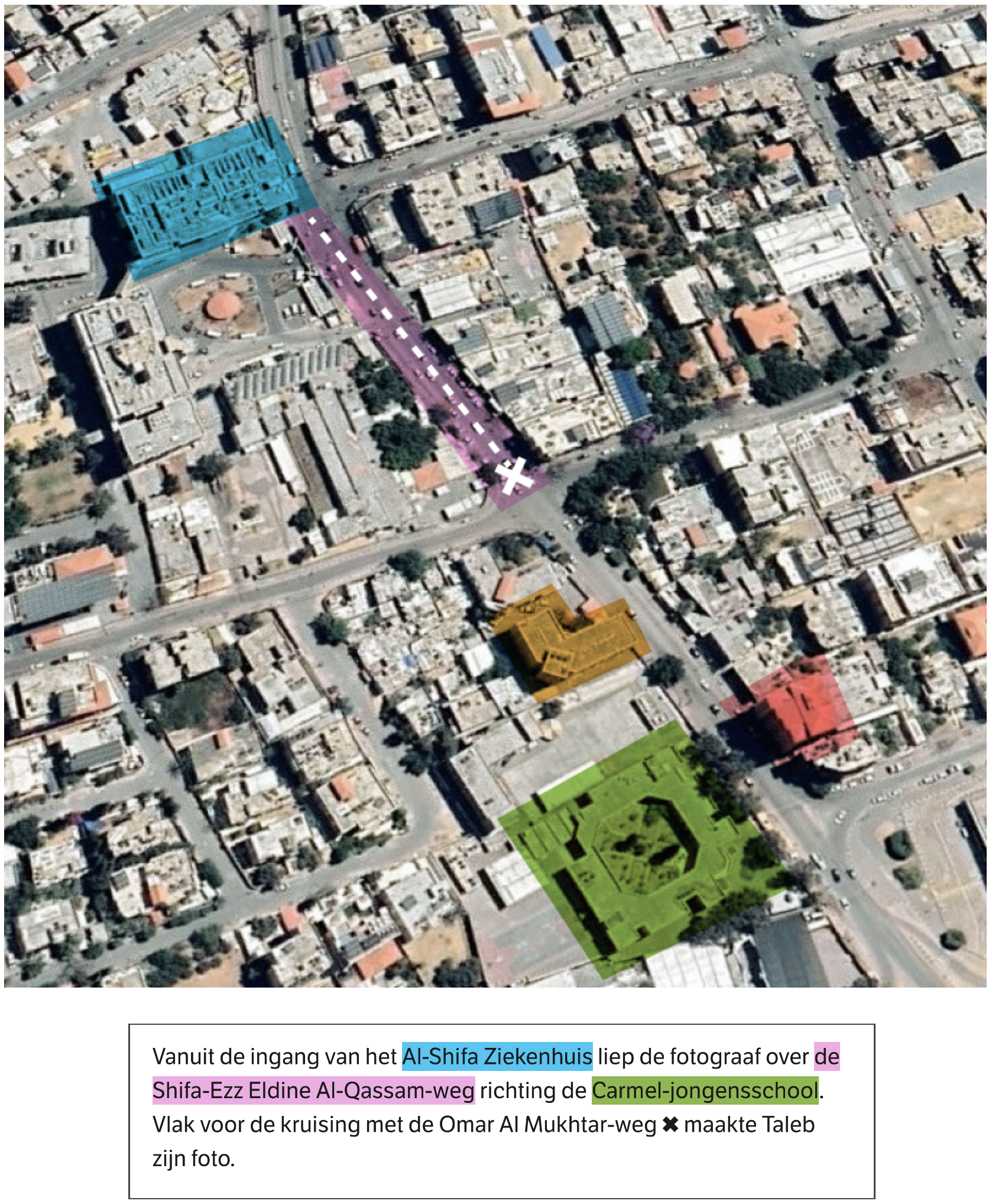
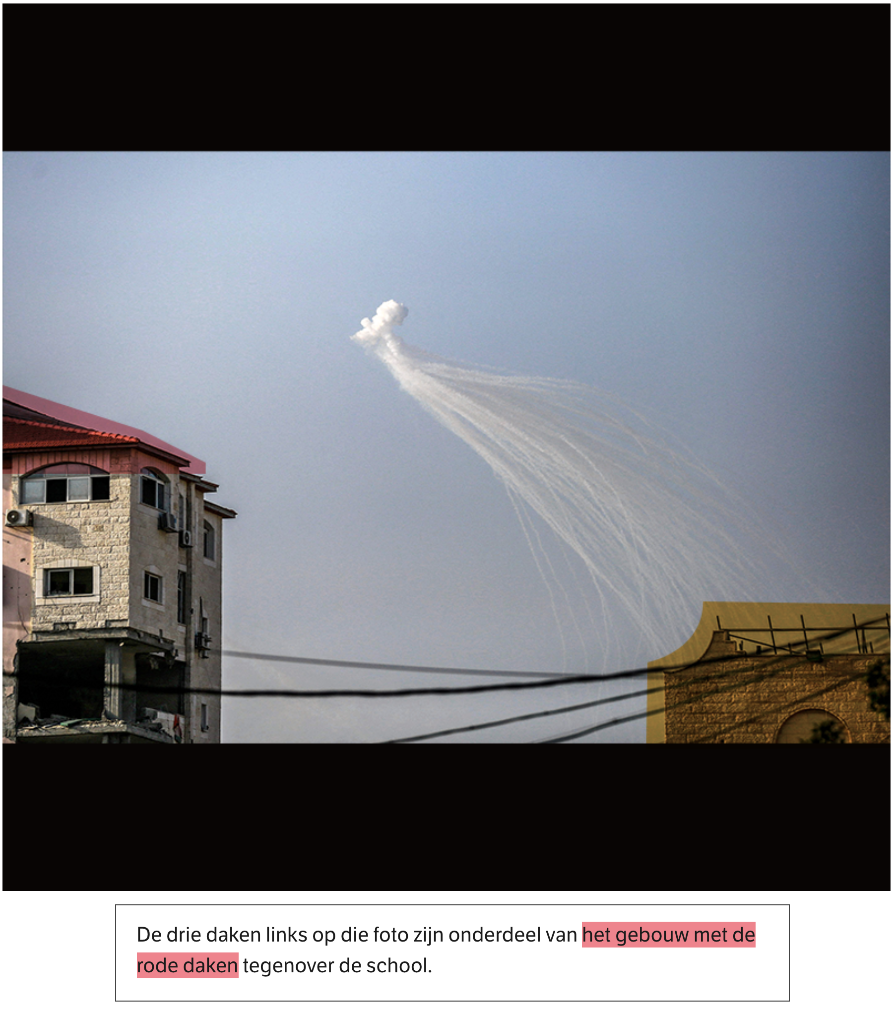
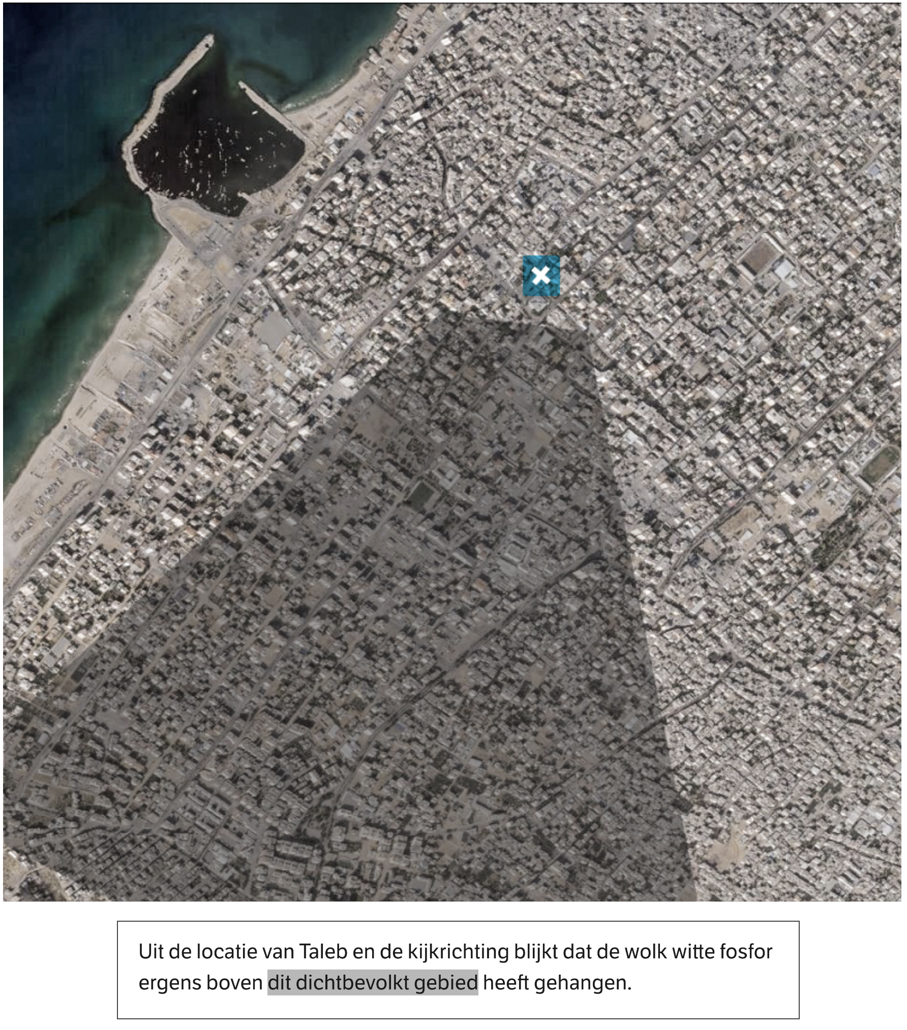
Through OSINT research, editors at NRC identified four locations in Gaza where the controversial white phosphorus bombs had been fired. They accomplished this by analyzing images of the smoke clouds and using geolocation techniques to pinpoint the exact locations. To confirm these spots, they cross-referenced multiple images of the same areas, taken from different angles, including satellite imagery.
The challenge, however, was how to clearly communicate that these various images depicted the same locations. To address this, I designed visual overlays that connected and clarified the relationship between these images, enabling us to effectively present this information in our news story.
Information design
Journalism
November 2023
More projects